Table of Contents
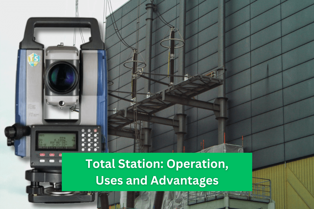
Total Station: Operation, Uses, and Advantages
Total Station: Operation, Uses, and Advantages
Table of Contents
Total Station: Operation, Uses, and Advantages
Welcome to our comprehensive guide on the operation, uses, and advantages of total stations. At Sunder Trading Company, we are committed to providing you with valuable insights and in-depth knowledge to help you understand the power of total stations in surveying and achieve optimal results in your projects.
A total station is a sophisticated electronic instrument widely used in modern surveying and construction applications. It combines the functionality of a theodolite (for measuring angles) and an electronic distance measurement (EDM) device, enabling precise measurements of both horizontal and vertical distances, as well as angles.
A total station utilizes advanced technology to streamline surveying processes. It consists of several key components, including a telescope, EDM unit, electronic data collector, and internal software for data processing and analysis. Let’s delve into each component in detail:
The telescope forms the primary visual component of a total station. It allows surveyors to observe and target specific points on the land, structures, or objects of interest. Modern total stations are equipped with high-quality optics, which provide clear and accurate images for precise targeting.
The EDM unit employs laser or electromagnetic waves to determine the distance between the total station and the target point. By emitting a beam towards the target and measuring the time it takes for the beam to return, the total station can calculate distances with exceptional accuracy.
Total stations are equipped with electronic data collectors or onboard computers. These devices facilitate the storage and processing of survey data. Surveyors can input important information, such as coordinates, angles, and distances, directly into the data collector, eliminating the need for manual record-keeping and reducing the chances of human error.
The internal software in a total station enables the processing, analysis, and manipulation of survey data. It allows surveyors to perform various calculations, such as coordinate transformations, area and volume calculations, and coordinate adjustments. The software also provides valuable tools for generating detailed reports and graphical representations of the survey results.
Total stations find extensive applications in diverse fields, including surveying, construction, engineering, and archaeology. Let’s explore some of the primary uses of total stations:
Total stations revolutionized land surveying practices by providing accurate and efficient measurements. Surveyors can use total stations to determine the positions of points on the Earth’s surface, establish boundaries, create topographic maps, and conduct various geodetic surveys.
Total stations play a crucial role in construction layout and site preparation. They allow precise stakeout of reference points, such as corners, columns, and structures, ensuring accurate placement during the construction process. This helps maintain alignment, avoid errors, and achieve superior project outcomes.
In engineering projects, total stations are utilized to monitor deformations and movements of structures over time. By regularly measuring specific points on the structure, surveyors can detect any changes or shifts, enabling timely interventions and ensuring structural integrity.
Archaeologists rely on total stations to document and map archaeological sites with exceptional precision. These instruments enable the accurate recording of artifact locations, excavation boundaries, and spatial relationships between different features. The data collected through total stations aids in the interpretation and preservation of historical sites.
Total stations offer numerous advantages that make them indispensable tools in modern surveying practices. Here are some key benefits:
With their advanced measurement capabilities and precise instrumentation, total stations deliver unparalleled accuracy in surveying. They enable surveyors to achieve sub-centimeter level measurements, ensuring reliable and dependable results.
Total stations significantly expedite the surveying process compared to traditional methods. Their ability to simultaneously measure angles and distances accelerates data collection, saving valuable time for surveyors and project teams.
Total stations seamlessly integrate with digital systems, allowing for efficient data transfer and analysis. Survey data can be easily exported to computer-aided design (CAD) software, Geographic Information Systems (GIS), and other specialized programs for further processing and visualization.
Total stations are versatile instruments that can adapt to a wide range of surveying requirements. Whether it’s land surveying, construction layout, or archaeological surveys, total stations offer the flexibility and functionality needed to tackle various applications.
A beginner friendly guide on how to operate a total station?
An advance guide on operating a total station:
In most modern Total Station instead of using plate level you can check the level with the high precision electronic level. The electronic level allows you very precise instrument setting, without rotating the instrument and checking the plate level twice. And you will be free from the maintenance.
Communication Data import and Export can be done by both serial cables connection and USB drive. Largest USB stick that can be used is 32GB.
Mode: Fine “r”* / Fine AVG)/ Fine “s”Rapid “r” / Rapid “s” / Tracking
Reflector: Prism* / Sheet / N-prism
PC (Prism constant): -30 mm Normal
Note) when selecting N-prism in Reflector, PC is set to “0”.
Scale: The observed coordinate is affected by this scale factor.
The angle and distance is not affected by this scale factor.
*In this video our technician Farman Khizer teaches how to operate HI-TARGET Total Station 220-R(Model).
Sokkia Software Total Station, 2” Angle Accuracy, 1” Display Reading, Reflectorless Range 600m, Dual side LCD display with alpha numeric keys Distance Range with Single Prism: 3000 meter, Distance Range with Triple Prisms: 6000m, Distance Dual Axis Compensator, Alpha Numeric Key Board, Internal Memory 20,000 points, Plug-in Memory SD Card Supported, Mini USB Slot, Dust and water protection: IP65 Operating Temperature: -20°C to +50°C, Operating time with one battery 16 hours (Approx.) Laser Plummet, & Charger with standard accessories.
Above mentioned accuracy is defined of “HI-TARGET HTS-220R Total Station”. These accuracy vary from brand to brand and also based on different models
Total stations measure distance by using a modulated infrared carrier signal, which is generated by a small solid-state emitter inside the instrument’s optical path. This beam is reflected off a prism or an object that the user wants to survey, while the modulated pattern of the returning signal is read and interpreted by a computer inside the instrument.
A total station is an advanced surveying instrument that combines a theodolite with an electronic distance meter (EDM), allowing for accurate measurement of angles, distances, and elevations. In contrast, a theodolite is a simpler instrument used solely for measuring angles and lacks the integrated EDM functionality of a total station.
In conclusion, total stations have revolutionized the field of surveying with their advanced technology and precision. Their ability to measure angles, distances, and collect data efficiently makes them invaluable tools for professionals across different industries. By understanding the operation, uses, and advantages of total stations, you can harness their power to achieve accurate and reliable results in your projects.
Remember, at Sunder Trading Company, we are dedicated to providing you with the latest insights and expertise to help you succeed in your surveying endeavors. If you have any questions or require further assistance, please don’t hesitate to reach out to our experienced team of professionals.
Keywords:-
total station, use of total station in surveying, surveying, principle of total station, advantages of total station, applications of total station, use of total station, total station in pakistan.