Table of Contents
List of Surveying Instruments and Their Uses
List of Surveying Instruments and Their Uses
Table of Contents
List of Surveying Instruments and Their Uses
What are surveying instruments and how do you use them? Surveying instruments are used to assist in measuring land, including vertical distance, horizontal distance, and volume of excavated material. A land surveyor uses surveying instruments to make precise measurements of the earth’s surface. From determining measurements in the field, questionnaires, or research of legal instruments, and data analysis in the support of planning, designing, and establishing of property boundaries and draw on map with relevant details.
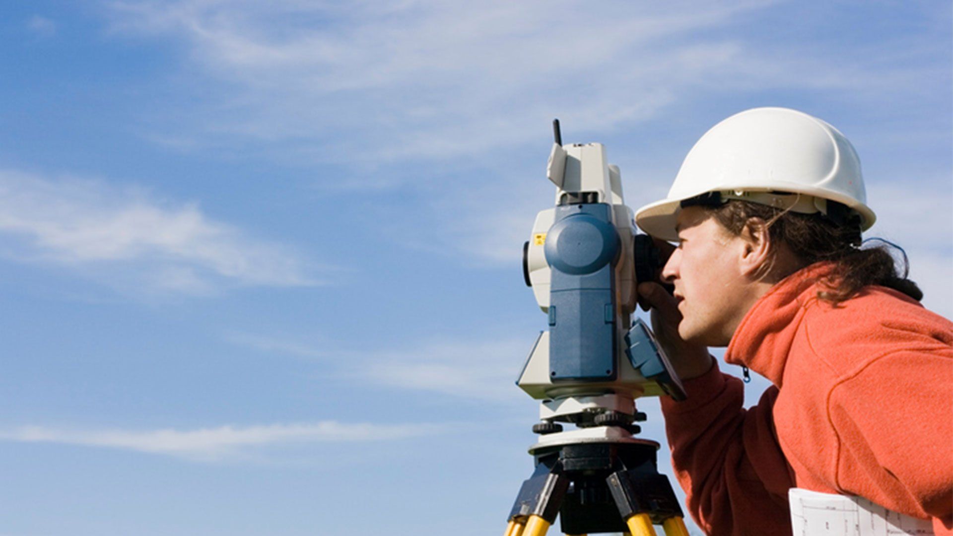
Instruments is an often-used word in surveying, but it can mean different things to different people. For example, some people refer to field books as instruments. Technically, a field book is more like what we call instrumentation – that is, all of your survey equipment or surveying instrument put together in one place for future reference. Other people refer to handheld computers as surveying instruments, but they might be thinking about something else altogether. A handheld computer is not an instrument per se, but it can be useful when doing certain kinds of calculations and running certain kinds of computations.
Basically These are the Instruments Used for Measurement of Land. Some uses are as follows:-
a) Instruments Used for Linear Measurements Chain or Tape Arrows Pegs Ranging Rods Offset Rods Plumb Bob Optical Square Line Ranger
b) Instruments Used in Angular Measurements Prismatic Compass Surveyors Compass
c) Instruments Used in Vertical Measurements Leveling Staff Dumpy Level Theodolite
d) Instruments Used for Measurement of area
Surveying Equipments are mostly used in
Land surveying is the detailed study or inspection, as by gathering information through observations, measurements in the field, questionnaires, or research of legal instruments, and data analysis in the support of planning, designing, and establishing of property boundaries and draw on map with relevant details.
A quantity surveyor is a construction industry professional with expert knowledge on construction costs and contracts. Qualified professional quantity surveyors are known as Chartered Surveyors in the UK and Certified Quantity Surveyors in Australia and other countries.
Topographic Surveying
Hydrographic surveying is the survey of physical features present underwater. It is the science of measuring all factors beneath water that affect all the marine activities like dredging, marine constructions, offshore drilling etc. Hydrographic surveying is mainly conducted under authority concerns.
Mine surveying is the practice of determining the relative positions of points on or beneath the surface of the earth by direct or indirect measurements of distance, direction & elevation.
Measuring Tapes, Measuring Wheel, Surveying Chains, Arrow, Peg, Ranging Rods, Offset Rods, Plumb Bob, Cross Staff, Optical, Square, Prism Square, Site Square, Tripod, Plane Table, Alidade, Plumbing Fork, Spirit Level, Trough Compass, Drawing Paper, Instruments for Direct Levelling, Distance meter, Bipod, Plumb Laser, Dumpy Level, Y Level, Reversible Level, Tilting level, Leveling Staff, Prismatic Compass, Surveyor’s Compass, Theodolite, Total Station, GPS/GNSS, 3D Scanner, Drones.
Some of the major Surveying Instruments are explained below:-
A total station is an electronic/optical instrument used in modern surveying and building construction that uses electronic transit theodolite in connection with electronic distance meter (EDM).It is also integrated with microprocessor, electronic data collector and storage system.
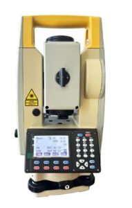
The instrument is used to measure sloping distance of object to the instrument, horizontal angles and vertical angles. This Microprocessor unit enables for computation of data collected to further calculate the horizontal distance, coordinates of a point and reduced level of point.
Data collected from total station can be downloaded into computer/laptops for further processing of information.
Total stations are mainly used by land surveyors and civil engineers, either to record features as in topographic surveying or to set oust features (such as roads, houses or boundaries). They are also used by archaeologists to record excavations and by police, crime scene investigators, private accident Reconstructionist and insurance companies to take measurements of scenes.
Learn More About Total Station
A dumpy level, builder’s auto level, leveling instrument, or automatic level is an optical instrument used to establish or verify points in the same horizontal plane. It is used in surveying and building with a vertical staff to measure height differences and to transfer, measure and set heights.Learn More About Auto Level
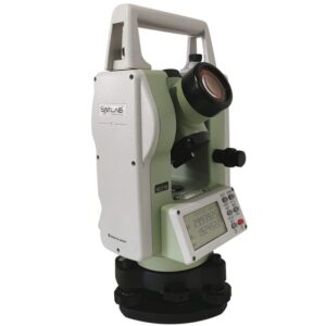
Basic surveying instrument of unknown origin but going back to the 16th-century English mathematician Leonard Digges; it is used to measure horizontal and vertical angles. In its modern form it consists of a telescope mounted to swivel both horizontally and vertically.A theodolite is a precision instrument for measuring angles in the horizontal and vertical planes. Theodolites are used mainly for surveying applications, and have been adapted for specialized purposes in fields like metrology and rocket launch technology. A modern theodolite consists of a movable telescope mounted within two perpendicular axes the horizontal or trunnion axis, and the vertical axis. When the telescope is pointed at a target object, the angle of each of these axes can be measured with great precision.
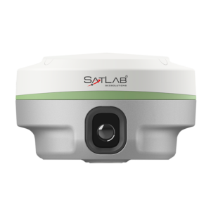 The Global Positioning System (GPS) is a space-based satellite navigation system that provides location and time information in all weather conditions, anywhere on or near the Earth where there is an unobstructed line of sight to four or more GPS satellites. The system provides critical capabilities to military, civil and commercial users around the world. It is maintained by the United States government and is freely accessible to anyone with a GPS receiver.
The GPS is a satellite-based navigation system made up of a network of 24 satellites placed into orbit by the U.S. Department of Defense. GPS was originally intended for military applications, but in the 1980s, the government made the system available for civilian use. GPS works in any weather conditions, anywhere in the world, 24 hours a day. There are no subscription fees or setup charges to use GPS.
Photogrammetry is the art and science of making accurate measurements by means of aerial photography:
Types of vantage points to acquire photographs?
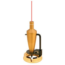 Dot-plumb lasers are a type of laser level that projects a small dot onto a surface. These dots are used for transferring points from wall to wall or ceiling to floor. It’s a handy tool for making sure a wall is plumb or even installing wall-to-wall.
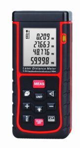 Laser measurement tools are based on the principle of reflection of a laser beam. To measure a distance, the device emits a pulse of laser in the direction of an object, for example a wall. The time necessary for the laser beam to get to the object and go back determines the measurement of the distance. In consideration of the speed of light, distances can be defined precisely with this kind of laser. Laser distance meters can also accumulate independently to calculate surfaces and volumes.
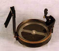 A prismatic compass is a navigation and surveying instrument which is extensively used to find out the bearing of the traversing and included angles between them, waypoints (an endpoint of the Closure) and direction.
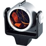 Optical Survey prisms are a specially designed retro reflector, specifically a corner reflector that is used to reflect the Electronic Distance Measurement (EDM) beam from a total station. A survey prism reflects the EDM beam back to its source with both a wide angle of incidence and with high precision.
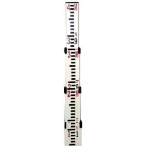 A level staff, also called levelling rod, is a graduated feet and meter on aluminum rod, used with a levelling instrument to determine the difference in height between points or heights of points above a vertical datum. It cannot be used without a leveling instrument.
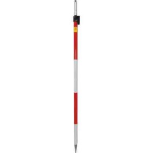 A prism pole can be used to measure the elevation of a specific ground point by using a sight level, which is important if you want to get accurate results. You can find a survey pole in a variety of materials — from metal and fiberglass to a variety of composites.
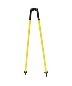 Find a collection of aluminum survey bipods, carbon fiber bipods, quick-release bipods, and more. Easy level adjustment for better precision & accuracy.
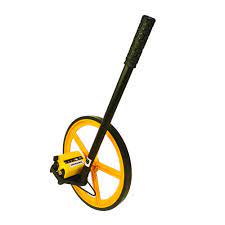 The measuring wheel – also known as a surveyor’s wheel, click wheel, perambulator, odometer, way wiser or trundle wheel – is a tool used to measure distances. Measuring wheels have a counting mechanism that counts the number of rotations and uses the circumference of the wheel to calculate the distance covered.
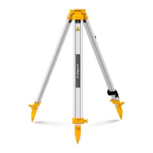 A tripod is a portable three-legged frame or stand, used as a platform for supporting the weight and maintaining the stability of some other object. It is used to give stability to other survey instruments as Total Station, Auto Level,etc.
When it comes to any field of surveying, having the right equipment/instrument is essential. Whether you are measuring angles, distances, or elevations, having the best instrument for the job will ensure speedy and accurate measurements for every application. Also the ease of use of an instrument is an essential factor which plays a role in quick and accurate measurements.
SUNDER TRADING COMPANY is the pioneer in sales , services & rentals for full range of surveying instruments for 36 years . Stc is the authorized distributor of SOKKIA, SATLAB, MATO, HI-TARGET, TOPCON, SANDING “Surveying Instruments” all over the Pakistan. A guarantee to provide our valued clients the best quality products. Always available 24 hours to serve you with passion. Also offering free training facility for SOKKIA, SATLAB, MATO, HI-TARGET, TOPCON, SANDING “Surveying Instruments” & award certificate.
Keywords:-
surveying, surveying instrument, surveying instruments, surveying instruments and their uses, uses of surveying instruments, survey equipment, surveying equipment, surveying equipments, how to use surveying instruments, types of surveying instrument, introduction of surveying instrument, survey instruments name, surveying equipment list, surveying instruments and their uses with pictures