Table of Contents
10 Surprising Uses for a Total Station
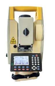
Surprising Uses for a Total Station: Total stations are essentially the 21st century version of the surveyor’s transit, which has been around for more than 100 years. Although these instruments still have their place in the modern surveying world, there are now many other uses for total stations that you might not have considered—that is, until now! Here are ten surprising uses for total stations that will change how you look at them—and their abilities—in the future.
 1) Finding buried utilities
If you’re in an excavation business, or if you’re surveying a piece of land for purposes of construction or development, then it can be important to know exactly where buried utilities are. If you’re digging around in someone else’s house, office, yard or building site, it would be pretty dangerous and irresponsible to not know where gas pipes and electrical cables are.
2) Surveying intersections
It may be unusual to think of surveying as something done on-the-go, but it’s actually quite common. Surveyors use total stations all over town to survey intersections and streets in preparation for future construction projects. A total station can also be used to map out existing infrastructure, including roads and buildings, making sure everything is in its proper place prior to any renovations or additions.
3) Building site topography
One of the Surprising Uses for a Total Station is Site topography. It is very important in construction projects. When buildings or roads are being constructed, they will be placed on a flat surface. If they were to be built on uneven ground, it could cause accidents and damage to property. To make sure that construction sites are level and safe, construction workers use surveying instruments to measure out and measure up. Topographic data helps contractors ensure that any concrete used is poured on even ground.
4) Topographic surveys
Topographic surveys are an important component of construction projects, as they provide clients with useful and detailed information about both existing and planned structures. If you’re responsible for surveying land that will be developed in some capacity, it’s a good idea to get in touch with your local surveying company to ask about topographic surveying services. Read on to learn more about why these surveys are so vital—and how topographic surveyors can improve your next project.
5) Real estate comps
A total station (also known as a tachymeter or tacheometer) is an instrument that combines digital distance measurement and electronic angle reading. This means it can be used to survey property by measuring both horizontal and vertical distances. With one instrument, real estate agents can now perform construction surveys, mortgage surveys, boundary line surveying, home site appraisals and many other related tasks much more quickly and accurately than ever before.
6) Site planning
This can be used to survey land prior to construction. If you need to know where your house should go, total stations are invaluable tools. It’s surprising how many people get their houses built and then realize that they don’t like their placement on the lot or what direction it faces. As such, total stations allow you to move around your house or other buildings before it gets built in order to find exactly where it should be located.
7) Drilling boreholes
Drilling boreholes requires precision and accuracy, since you’re literally digging into the earth. Surveyors rely on total stations to make sure they dig exactly where they need to—and not an inch more. A compact, handheld instrument can give you extremely precise measurements and is often much easier to use than traditional surveying equipment. Traditional total stations are also useful in other industries where accuracy is key.
8) Creating contour maps
Although total stations are most often used to create boundary maps, they can also be used to create topographic maps and contour maps. You’ll need a digital cartographer (DCP) to get started, but if you have access to one of these survey instruments, there are many additional uses you can harness from them. Here are 10 of them
9) Creating cross sections and vertical profiles
Before you can create an accurate 3D model of your building, you need to know its basic outline: In order to get that, surveyors and engineers usually start by creating cross sections of buildings. Depending on how big your building is, it can be difficult to perform these surveys by hand. That’s why many professionals use total stations—also known as RTK GNSS receivers or construction lasers—to produce more accurate results than tape measures ever could.
10) Working with CAD
One of the most obvious uses of a total station is to use it in conjunction with CAD. Rather than walking or driving around and taking multiple measurements, you can quickly and easily take all your measurements from one location using a total station. You can then create an almost perfect 3D model of what you are building without having to constantly go back and forth between different points. This will save both time and money in addition to improving quality.
Buy A “Total Station” Now.
OR Check Our Other Blogs.