Table of Contents
What Is Surveying?
Surveying Equipments And Their Uses In Surveying is a means of making relatively large-scale, accurate measurements of the Earth’s surfaces. It is the technique, profession, art, and science of determining the terrestrial or three-dimensional positions of points and the distances and angles between Earth’s Surface by taking direct or indirect measurements of distance, direction, and elevation.

Types Of Measurements:
Two types of measurements are taken in surveying:
- Linear measurements
- Angular measurements.

What Is Surveying In Civil Engineering?
Civil surveying is an engineering operation that involves assessing and recording details about an area of land. These observations can then be used to help plan construction projects. The main purpose of surveying in civil engineering is to determine the three-dimensional relationships between different locations.

Types of Surveying Equipments
- Chain
- Theodolite
- Traverse
- Triangulation
- Tachometric
- Plane table
- Photogrammetric
- Aerial
What Is A Surveyor?
A surveyor is a professional whose job it is to assess the structural integrity and value of a property. … Building surveyors, are experts in structural issues. They can assess the construction methods of a building, look for signs of defects and evaluate how they have occurred. They can then advise on remedy and the associated cost.
Main Objectives of Surveying
The primary objective of surveying is to prepare a map to show the respective positions (coordinates) of the points of objects located on the surface of the earth which is then used for the preparation of plans of different construction works such as buildings, roads, railways, canals, etc.. The map is prepared on a suitable scale.
Importance of Surveying
- Planning and design of all civil engineering projects such as construction of highways, bridges, tunnels, dams etc require measurements from surveying.
- During execution, project of any magnitude is constructed along the lines and points established by surveying.
- The data from a survey can show the current state of a company or a city. If the information is wrong, than this can be used to plan out immediate action.
- Coordinates can be established or determined with the help of surveying.
- Surveying provides spatial data base for city management or construction.
- A map of the land surface can be prepared with the help of surveying.
Applications of Surveying
- Land surveying (also known as Cadastral Surveying) …
- Engineering surveying. …
- Mining surveying. …
- Hydrographic (Bathymetric) surveying. …
- Geodetic surveying. …
- Aerial (Photogrammetry and remote sensing) …
- Topographic (Detail/Tachymetry) …
- Notes.
Surveying Equipments Types & Uses
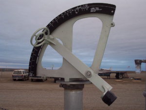
Alidade
The term alidade can refer to the sighting mechanism of any instrument used for surveying or navigation. The alidade is used for determining the directions of objects and is commonly deployed in detailed survey.
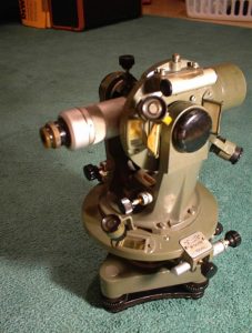
Theodolite
A theodolite can be used to measure both horizontal and vertical angles. And it can be mounted on a telescope that will allow you to move horizontally or vertically along a rotational axis. It has great precision in determining horizontal and verticalangles to a specific point.
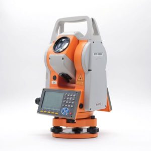
Total Station
It is an electronic transit theodolite with an electronic distance meter (EDM).
The crosshairs on the reflector of TS are aligned to the ranging rod and the vertical and horizontal angles are measured along with slope distances simultaneously.
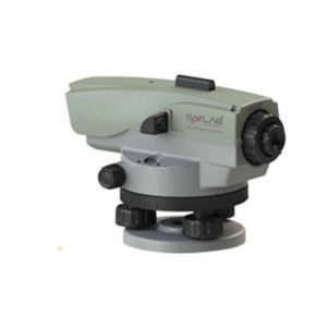
Auto Level
A dumpy level, builder’s auto level, leveling instrument, or automatic level is an optical instrument used to establish or verify points in the same horizontal plane. It is used in surveying and building with a vertical staff to measure height differences and to transfer, measure and set heights.
What Brands We Deal In?
“We Deal In All Kind Of Surveying Instruments”


Summary
Uses of Surveying Instruments can be understood as an art of deducing the relative position of the points on, above, or below the earth’s surface by taking direct or indirect measurements of distance, direction, and elevation.
Surveying holds importance in various civil engineering works. Establishing border lines, control points, hydrographical mapping, etc. are some of the broad fields of application of surveying.
These are not the only instruments used in surveying. There are variety of other surveying instruments and equipments used in surveying. Surveying has a variety of other fields. It provides variety of uses to our daily civil life.
“Surveying Is The Future Of Civil”
Want to buy a surveying instruments? Check out Our Products or Contact Us.
Keywords:-
surveying instruments, uses of surveying instruments, surveying instrument, surveying instrument and their uses, what is survey, what are survey instruments , surveying instrument , best surveying instrument, civil surveying instruments, instruments used in surveying